![]()
Tasmanian clearfell logging exposed
See extent of clearfell logging planned for all public native forest in Tasmania (2006/2007 logging season). See detailsNew rainforest website for Eastern Victoria
The Victorian Rainforest Network (an off-shoot of OREN) has launched a website that provides a new way to learn about rainforest and native forest logging issues (on public land) in 3D for East Gippsland and the Central Highlands.See www.vicrainforest.org.
Clearfell logging exposed using Google Earth
3D virtual reality perspective
The Otway Ranges Environment Network (OREN) has developed overlays for use with Google Earth to expose the impacts of native logging across southern Australia.
What is Google Earth?
Google Earth is a 3D virtual reality model of the entire world. To use the free version of Google Earth you need a computer that is generally less than three years old. Go to the Google Earth website for more details.
The following Otway overlays have been created for Google Earth.
Overlays for the Great Otway National Park
Download boundary line location of the Great Otway National Park![]() for Google Earth. See example image below.
for Google Earth. See example image below.
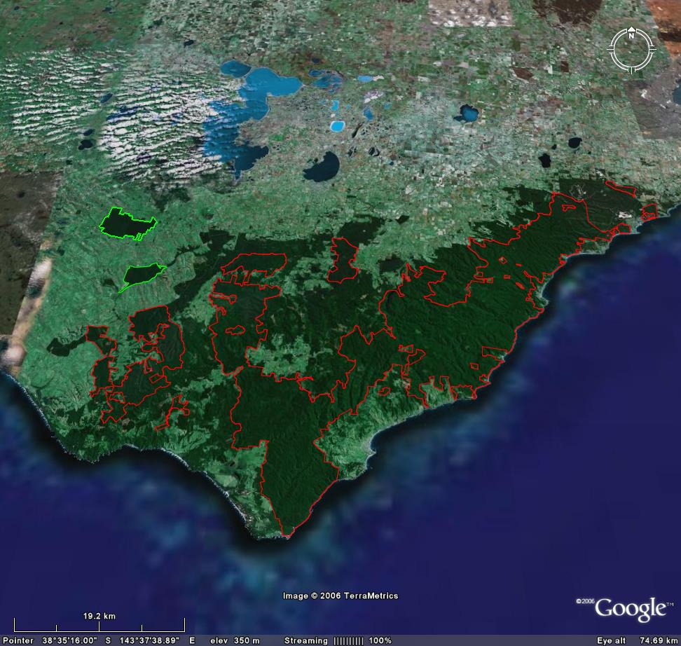
Red lines are the National Park boundary. Green lines are new nature conservation reserves.
Download Victorian Environmental Assessment
Council(VEAC) final recommendation map![]() for Google Earth.
for Google Earth.
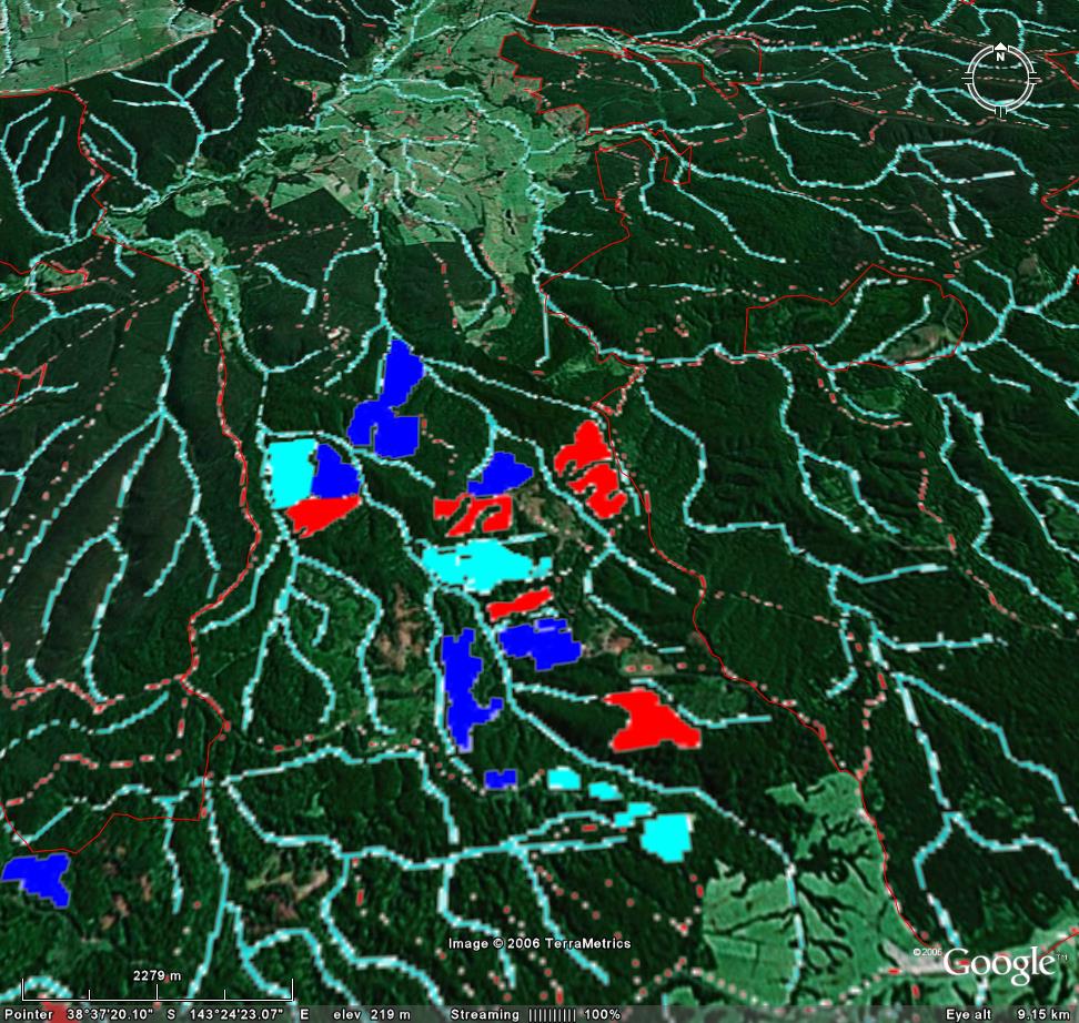
Overlays for logging until 2008.
Clearfell logging was halted after 2008 in the Otways. See where the last few years of logging was planned to occur (2006-2008) by downloading this Otway logging overlay![]() . Note that not all areas were logged and Google Earth images may not have been updated.
. Note that not all areas were logged and Google Earth images may not have been updated.
See example image below.
Don't know the meaning of a word? Check the glossary.