Clearfell logging Tasmania exposed with Google Earth
What is Google Earth?
Google Earth is a 3D virtual reality model of the entire world. To use the free version of Google Earth you need a computer that is generally less than three years old. Go to the Google Earth website for more details.
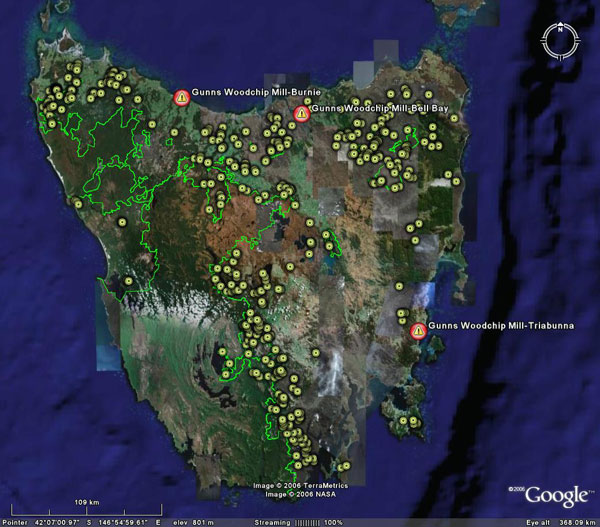
See GUNNS Woodchip Mills and the location of proposed GUNNS pulp mill.
Click here to see the current Gunns woodchip mills and proposed pulp mill location with Google Earth![]() .
.
Click here to find out more about Gunns, the company that makes money from woodchipping Tasmania's native forests.
Clearfell logging Tasmania
Ever wanted to see how much forest is clearfell logged in Tasmania every year?
Did you know the Tasmanian Government has allocated 172 square kilometres of public native forest to be clearfell logged and woodchipped in Tasmanina this financial year with about half the are to be converted into tree farms?
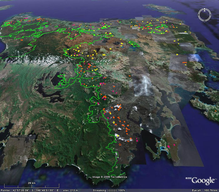
The following overlays for Google Earth which show the extent of all clearfell logging planned for Tasmania public native forest in the 2006 / 2007 logging season.
Download into Google Earth (Tasmania logging overlay 06/07 420kb)![]()
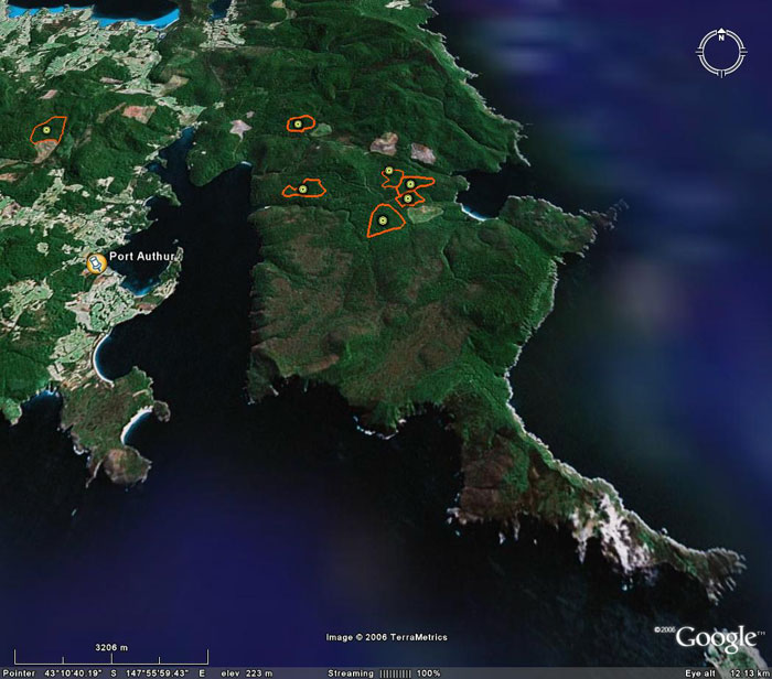
Logging operations are colour coded as follows:
![]() = clearfell (return to native forest).
= clearfell (return to native forest).
![]() = clearfell (convert to plantation).
= clearfell (convert to plantation).
![]() = other types of logging (similar to clearfell).
= other types of logging (similar to clearfell). ![]() = National Parks and dedicated reserves. (only indicative reserve boundaries near logging shown)
= National Parks and dedicated reserves. (only indicative reserve boundaries near logging shown)
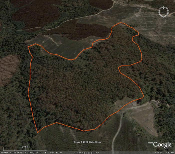
By clicking onto the placemark "circles" for each area that is to be logged, a pop up box will appear with specific information about that logging operation. The pop-up box will allow you to download more information into Google Earth.
Tasmania native forest destroyed for tree farms.
After the forest is destroyed by logging, the Tasmanian government is converting many of these areas into plantations or tree farms. These areas are marked as orange. The pink areas will be allowed to regrow into native forest again but will be logged in 60 to 80 year crop rotation.
A total of 155 areas, or 57 square kilometres of native forest will be converted to plantations in this one year's logging.
The practice of plantation development is basically the same as land clearing for agricultural development. The biodiverse natural environment will never be allowed to return. Both the current Federal Government and Tasmanian State government support the conversion of public native forest into plantations, despite this practice being banned in every other state in Australia and condemned around the world.
OREN believes that the government is trying to convert as much forest as possible into plantations before 2010, the year that they've promised to stop the forest to plantation conversion.
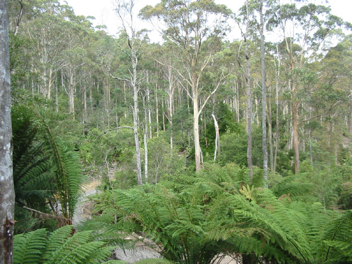
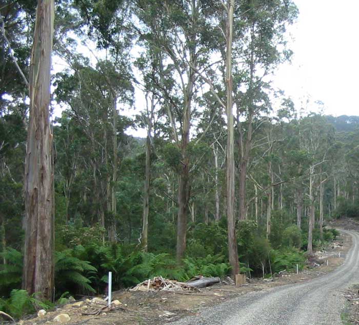
On the ground much of the forest clearfell logged looks like that pictured below. This particular forest photo was taken at the Blue Tier in the North East of Tasmania in March 2004. This forest has now been clearfell logged and woodchipped.
Forestry Tasmania made transparent
These overlays for Google Earth were created to make information about where logging takes place more accessible to the public and help put the Tasmanian logging situation into true perspective. Currently there are 1400 individual logging coupe maps on the Forestry Tasmania’s website which are hard to read and interpret, particularly at the mass scale. Now the public can see one year of planned logging at the same time in the Google Earth 3D virtual reality landscape.
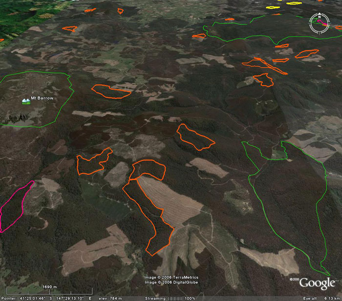
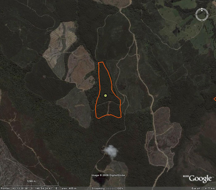
The Forestry Tasmania maps can be overlayed onto the Google Earth as shown below. To view this map click on the place mark and select that option from the pop-up box.
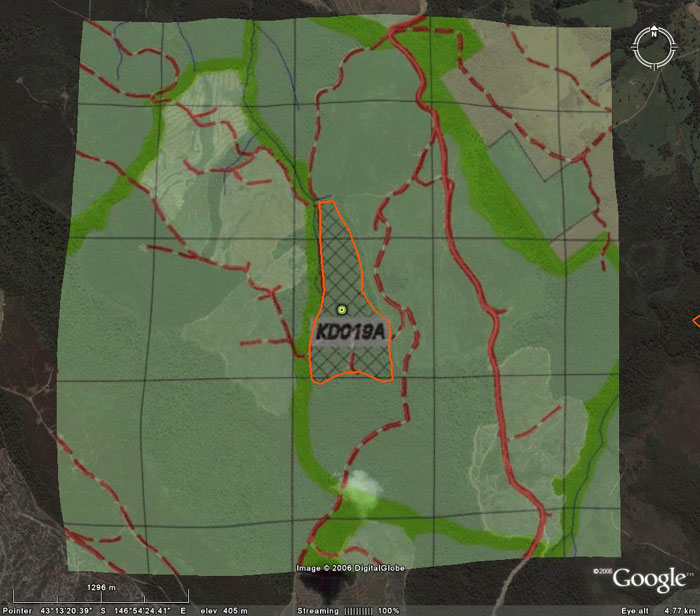
The cross hatched areas on the Forestry Tasmania logging coupe maps mark the area to be clearfell logged. The boundary of these areas has been traced to get the final result for each logging coupe shown below. The forestry roads that show up on Google Earth aid in aligning the image.
The image below (again from the Blue Tier) is an example of a forest logging road as seen from the ground. The forest pictured in this image has already been clearfell logged and woodchipped.
Clearfell Logging for woodchips on Bruny Island

Clearfell logging for woodchips near Port Arthur and the Tasman Peninsula
Don't know the meaning of a word? Check the glossary.